• USA
  • 3 months

Innola

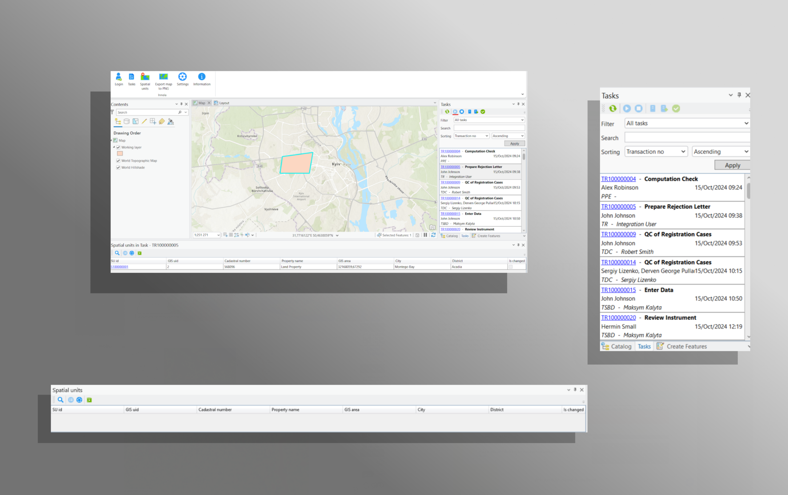
An ArcGIS Pro extension that enables automated two-way synchronization of spatial data between map features and the Innola enterprise system. It allows users to work with files, tasks, and business data directly inside ArcGIS Pro — eliminating the need to switch between platforms.

  • GIS
  • https://www.innolasolutions.com/
[ 01 ]
Client Review

The Breeze Software team demonstrated strong expertise in working with ArcGIS Pro and integrating it with our Innola system. The solution was delivered quickly and fully met our expectations. The developed ArcGIS Pro extension ensured seamless integration with the Innola platform, enabling specialists to work with geospatial objects, files, and tasks within a single environment, with automatic data synchronization between systems. The solution integrates naturally into the ArcGIS Pro interface and feels like a native part of it, which allowed for fast adoption without additional team training. We are satisfied with the results of our cooperation and recommend Breeze Software as a reliable partner for delivering GIS solutions.

Ihor Popiv
Managing Director, Innola Solutions
[ 02 ]
Client Challenges / Goals

01

Enable seamless integration between ArcGIS Pro and Innola.

02

Automate the exchange of spatial objects and attachments.

03

Reduce manual operations and human errors in GIS workflows.

04

Improve efficiency and accuracy for GIS specialists.

[ 03 ]
Tehnologies, we used in this project
[ 04 ]
Main Results
[01]
Innola API integration —
automated retrieval and submission of spatial objects and attachments.
[02]
Automatic data linking —
map features are linked to related Innola records.
[03]
Task execution inside ArcGIS Pro —
users can perform tasks and file operations using their permissions.
[04]
Native ArcGIS Pro UX —
seamless interface aligned with Esri standards.
[ 05 ]
Project Metrics
+15%
15% increase in new applications submitted to Innola after the extension rollout.

Do you want a similar project?

Contact an Expert
[ 02 ]
Cases
[GIS, Situation Centers, Video Surveillance & Security Systems]
Ukraine
Frontier

An intelligent platform designed to manage a distributed network of security cameras.

The solution combines a map interface, technical camera parameters, and live video streams in a single environment, enabling operators to quickly assess situations, monitor system health, and make decisions in real time.

[Agritech, GIS]
Ukraine
Statistical Module

A comprehensive web service for analyzing land-use patterns in Ukraine using Sentinel satellite data. The system identifies crop types, detects discrepancies between satellite imagery and official parcel boundaries, and generates multi-year land-use records to support agricultural monitoring and improve financial access for smallholder farmers.

[Agritech, GIS]
Ukraine
Transparent Export

A module integrated into the State Agrarian Registry that provides a transparent and standardized process for verifying agricultural exporters. The solution allows companies to submit verification requests, track their status, and access up-to-date verification results. It is designed to reduce administrative workload, increase process transparency, and ensure that government authorities can quickly access accurate and verified exporter information.


More cases
Let's Discuss Your Project!
Expected budget
  • < $40k
  • $40k – $100k
  • $100k – $200k
  • > $200k
  • N/A
Maksym Robochyi